
Today I want to share A Lady in London’s self-guided Regent’s Canal walk with you. This tour will take you through a number of areas that border one of the city’s most famous waterways. It’s a great walk to take if you love exploring London on foot and seeing a variety of neighborhoods as you go. I’ve included a detailed Regent’s Canal walk map to help you get around, too.

Regent’s Canal Walk
Many people don’t realize that when it comes to the UK capital, the Thames isn’t the only waterway that matters.
A whole system of canals runs through London. They offer a more local alternative to walking along the river, and they’re fun ways to see colorful canal boats and watch everyday life in the city unfold.
I particularly like walking along Regent’s Canal. An 8.6-mile (13.8-kilometer) waterway, it’s packed with cheerful boats and it bisects many of the most exciting areas in the northern part of central and east London.
Regent’s Canal goes from Little Venice in the west to the Limehouse Basin and the Thames in the east.
En route it cuts through Maida Vale, Regent’s Park, Camden, King’s Cross, Islington, Hackney, London Fields, Victoria Park, and other parts of the city. It’s a great place for a walk in London.

Regent’s Canal Walk Route
I’ve written up canal walks in London before. They’ve covered the Regent’s Canal walk from Little Venice to King’s Cross. While popular, it’s not the only part of the waterway that’s worth a wander.
As such, today I want to share a self-guided Regent’s Canal walk that will take you from the heart of King’s Cross to hip Hackney. Along the way you’ll discover everything from quiet basins to cool bars and weekend markets.

If you want to, you can combine it with my other canal walk to do a longer one. This one starts where the other ends, so it’s easy to do both in one day. The combination is one of the best London canal walks.
Whichever way you decide to do it, this walking route will take you past lots of great places. There are plenty of spots to eat and drink, too. It’s easy to get a meal, snack, or coffee along the way if you need one.

Self-Guided London Walking Tour
This Regent’s Canal walk starts at King’s Cross station. It’s on multiple London Underground lines, bus routes, and train lines, so it’s easy to get to.
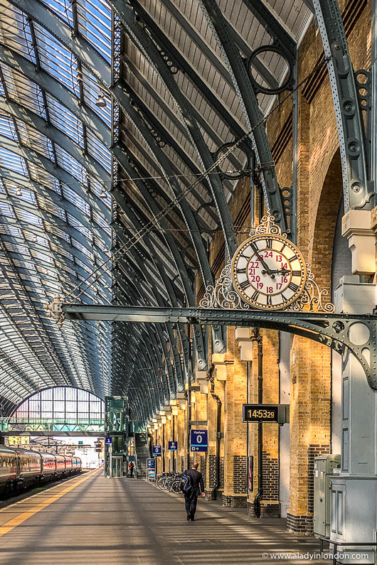
King’s Cross
When you arrive, exit the station to the north and walk up the pedestrianized King’s Boulevard. You’ll pass lots of shops and restaurants as you go.

When you get to Goods Way, cross the bridge into Granary Square and turn right into Wharf Road Gardens to get onto the Regent’s Canal Towpath.
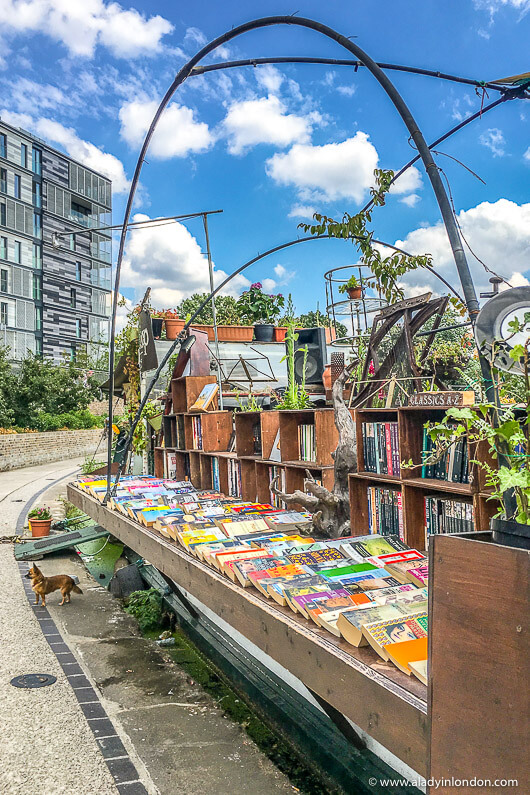
When you get to the canal you’ll see Word on the Water, one of the most unique independent bookshops in London. It’s set in a canal boat and it’s always fun to browse the titles.
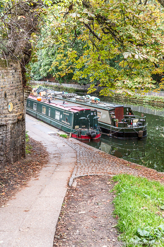
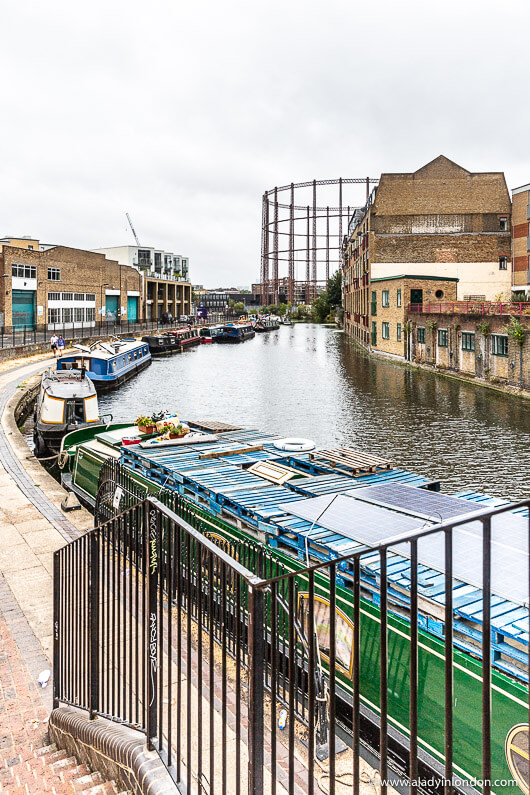
After looking at the books, follow the towpath east and take in the basins and buildings as you make your way under Caledonian Road in Barnsbury. Soon the canal will go underground and you can take the path up to the road to get to where it starts again.

Islington
Head up to Muriel Street, turn right, and cross the street where it’s safe. You’ll see a narrow path through a housing estate in front of you, and you can follow it until you get to Maygood Street.
Head east on Maygood Street, cross over Barnsbury Road where it’s safe, and continue east on Dewey Road. It will take you straight into Culpeper Park, a little community garden in Islington.

Make your way through the park to Cloudesley Road and turn left when you get there. Take your first right onto Ritchie Street, where you’ll see some of the brick houses and colorful doors this part of London is known for.

At the end of Ritchie Street, cross over Liverpool Road where it’s safe and continue east on Bromfield Street. This picturesque stretch will take you to Berners Road, where you can turn left and follow the curve to Upper Street.
Cross Upper Street where it’s safe and continue east on Charlton Place. You’ll soon find yourself at the intersection of Camden Passage, which has a fun market and lots of shops and cafes.

You can explore it if you want to, or continue your Regent’s Canal walk by going east past the beautiful heritage buildings.

When Charlton Place meets Colebrooke Row, turn right and make your way down to the canal. The waterway starts up again here, and you’ll turn left to get back onto the Regent’s Canal Towpath.
Angel
This part of the canal walk will take you through Angel. You’ll pass by lots of colorful boats as you make your way towards City Road Basin and Wenlock Basin.
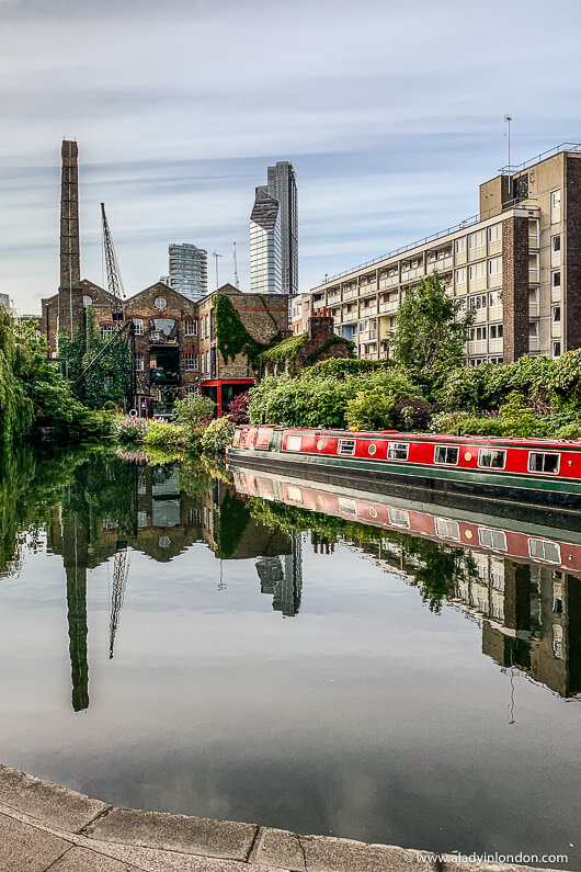
Hoxton, Dalston, and De Beauvoir Town
When you get to them, you’ll start to notice pop-up bars and cafes along the canal. With Hoxton to the south and De Beauvoir Town and Dalston to the north, there are lots of hip east London establishments around.

Haggerston
Your Regent’s Canal walk continues as the waterway winds through Haggerston.
This is one of the trendiest east London neighborhoods, and there’s everything from bars to restaurants and coffee shops along the Kingsland Towpath and in the area around Kingsland Basin. Street art abounds, too.
Hackney
Leaving Haggerston, the route will take you along Regent’s Row as you make your way into Hackney and the area around London Fields.
If it’s a Saturday, it’s worth popping off the path to go to Broadway Market. This street comes alive with a market of the same name, and it’s a great place to pick up some food for a picnic in the park in London Fields.

At this point you can either walk up to the London Fields Overground station or continue your Regent’s Canal walk along Pound Path to Victoria Park and beyond.
Whichever way you choose, your self-guided Regent’s Canal walk ends where you want it to.
Regent’s Canal Walk Map and Details
First Half of the Regent’s Canal Walk Map: https://goo.gl/maps/btY1LZGauGXeiw4X7
Second Half of the Regent’s Canal Walk Map: https://goo.gl/maps/9gBXhUzyaHsbhsRH8
Further afield: Mile End Park, Limehouse Basin, Thames

More Self-Guided Walks in London
I’ve published many more London walks and pulled them together in my London walking tours blog post.
There are other walks to be discovered in London’s Hidden Walks, too. You can get it here. There are more ideas in my London walking books post as well.
I’ve also written my own account of doing a Regent’s Canal walk in London. You can read it here.
Happy walking!
Find this post helpful? Buy me a coffee!
New here? Join thousands of others and subscribe to the A Lady in London blog via email.
One of the links in this blog post is an affiliate link. At no cost to you, I earn a small commission when you click on it and make a purchase. It doesn’t affect the way you shop, and it’s a great way to support the A Lady in London blog.
Pin it!
A fantastic walk no matter how much of it you do. So many times in London I find myself walking along a section of it.
I’m glad to hear that!