
Today I want to share my guide to a Marlow walk in Buckinghamshire, England with you. This country walk near London is an easy way to get out into the Chiltern Hills Area of Outstanding Natural Beauty. Along the way there’s riverside scenery and beautiful countryside to take in. Read on for the route description and photos. I’ve included a Marlow walk map as well.

Marlow Walk
This Marlow walk is ideal if you want to go on a country ramble along the Thames not far from London. It starts and ends right in the heart of Marlow, so you can combine it with a trip to this pretty town in Buckinghamshire if you’d like to.

How to Get to Marlow
Marlow is around an hour by car from London. There’s plenty of parking in town, so this is an easy walk to do if you drive.
If you want to travel by public transport, there are trains from London Paddington to Marlow via Maidenhead. The journey takes just over an hour.

Marlow Circular Walk
I’ve arrived in Marlow by car with friends. We’re excited to get out into the English countryside, and we can’t wait to see what the Thames and the Chilterns have in store for us.
Our Marlow circular walk route will cover around 6.3 miles (10.1 kilometers). It will take us through the town, along the river, and into woodland areas with archaeological sites. It’s flat in terms of topography, so we look forward to an easy ramble.

Walk Directions
Once in town, we start our Marlow walk on the high street. It’s lined with pretty shops, pubs, and restaurants. I want to stay all day exploring, but we have a path to follow.

After walking down the high street, we continue our Marlow walk by heading across Higginson Park to the Thames. When we get there, we take in the views of the boats, bridge, and church steeple before and heading up the river on the towpath.
Along the way we spot All Saints Church and Tudor landmarks like Bisham Abbey. The manor house was once owned by Anne of Cleves, wife of Henry VIII’s from his short-lived fourth marriage. Elizabeth I was a regular visitor, too.

We walk for 1.5 miles (2.4 kilometers) to get to Temple Lock, which was built by the Thames Navigation Commissioners in 1773.
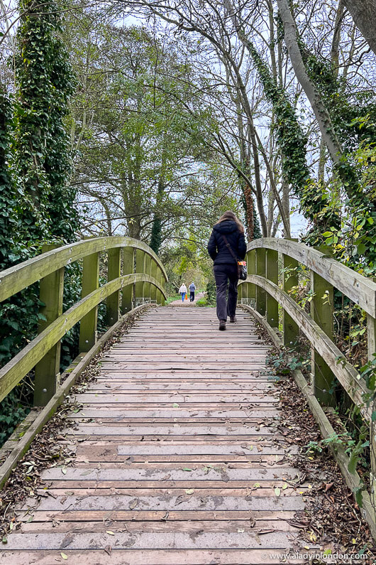
We then go a bit farther to get to the Temple Footbridge. Built in 1989, it connects the Buckinghamshire and Berkshire sides of the Thames Path and offers great views over the river.

Back at Temple Lock, we follow the path away from the Thames and continue our Marlow walk by heading into the countryside. We pass places like East Lodge, Harleyford Manor, a golf course, and Home Farm House before finding ourselves in Rassler Wood.

Rassler Wood is a woodland area with trees ranging from horse chestnut to holly. It’s peaceful here, and the atmosphere is exactly what I expected from the countryside.
We continue our walk through Pullingshill Wood, Marlow Common, and Davenport Wood. As we go, we pass by ancient earth banks and trenches that were used for training soldiers during World War I.

Eventually the path brings us to an open area from where we make our way down a road leading to the high street in Marlow. Our Marlow walk ends in the heart of town, where we stop for drinks at a local pub.
The walk has taken around 3 hours to complete, including photo stops and a break for snacks. It’s been a great day out, and I’m glad I’ve gotten to enjoy another country walk in Britain.

Marlow Walk Map
If you want to go on this Marlow walk, you can find a map here. It covers the route we did, and it has an alternative if you want a shorter walk. There are additional routes here.
You can see more walks in the area in the book Time Out Country Walks: 52 Walks Near London, too. You can get it on Amazon here.
Marlow Walk
I hope you’ve enjoyed this Marlow walk guide and that it’s made you want to get out into the English countryside in Buckinghamshire. Happy hiking!
Find this post helpful? Buy me a coffee!
New here? Join thousands of others and subscribe to the A Lady in London blog via email.
One of the links in this blog post is an affiliate link. At no cost to you, I earn a small commission when you click on it and make a purchase. It doesn’t affect the way you shop, and it’s a great way to support the A Lady in London blog.
Pin it!
I’m from New Zealand but we lived in Marlow for 14 months five years ago. It’s such a beautiful place and we were lucky enough to live right by Marlow Lock which I think offers one of the most beautiful views of Marlow towards the bridge. We miss it very much, so thank you for this blog and its lovely photos which bring back so many great memories.
You’re welcome! I’m glad it brings back good memories.